
PEATLAND CLIMATE FOUNDATION · OUR PROCESS
From extraction site to living peatland
Eight science-based steps – from the first screening to up to 40 years of monitoring.
Every PCF project follows the same process. Each step produces data that the next one builds on – so that every hectare we restore is backed by field measurements, maps and long-term monitoring.
Assess
01 Target analysis
02 Quick scan
Secure
03 Land agreement
Measure & plan
04 Baseline study
05 Restoration plan
06 Monitoring concept
Restore & monitor
07 Implementation
08 Long-term monitoring
1
Assess
Target analysis
We screen drained peatlands and former extraction sites across the Nordics and Baltics for their climate potential, using peat inventories, land-use maps, aerial and satellite imagery.
Peat & land-use maps
Aerial & satellite imagery
Site shortlist
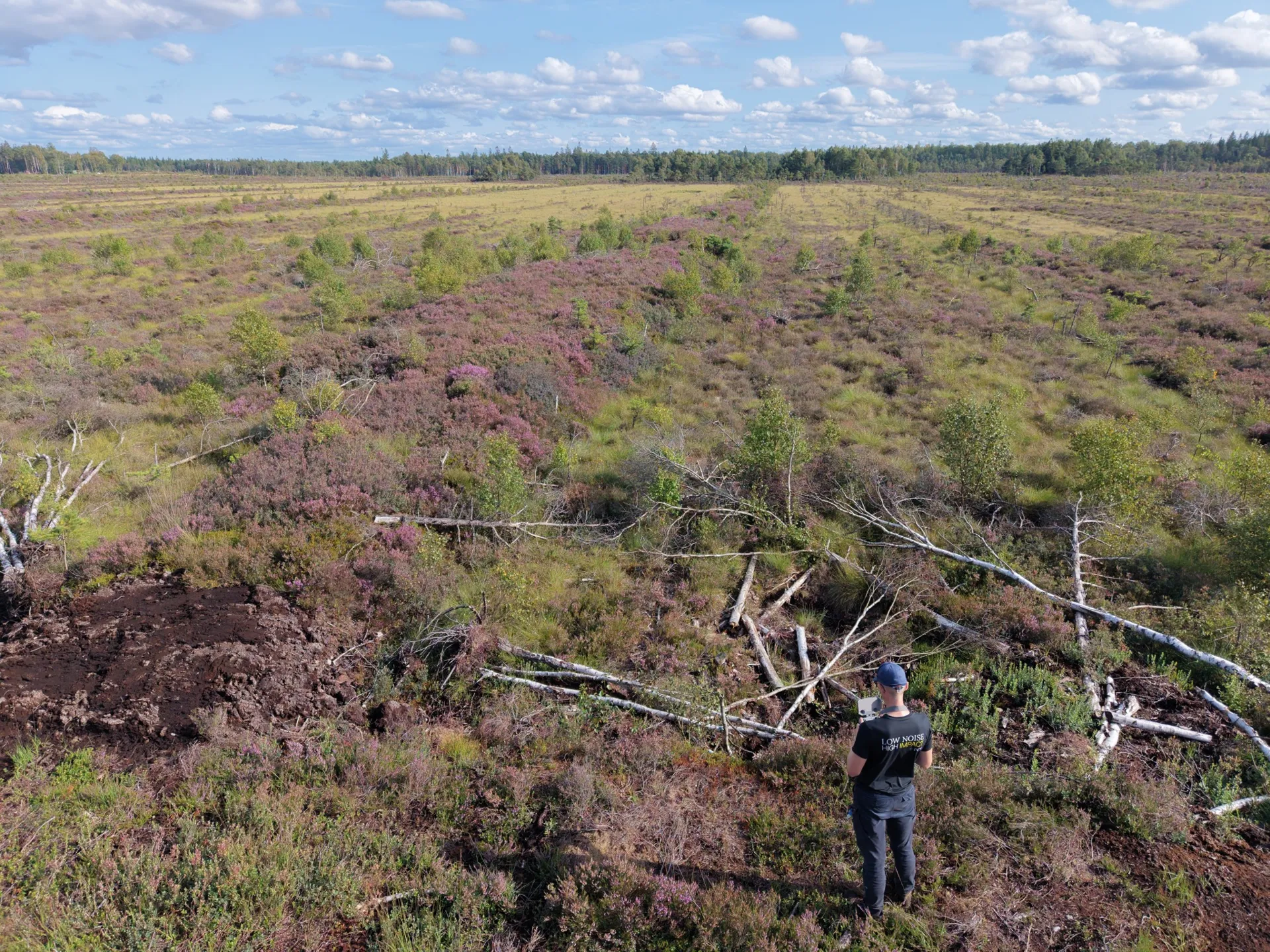
Aerial screening of a candidate site – Storflon
2
Assess
Quick scan: GHG emission savings potential
A first estimate of the emissions that rewetting can avoid – based on peat depth, area and current land use. Only sites with a clear climate benefit move on.
Emission factors (GEST)
Peat depth estimate
Go / no-go decision
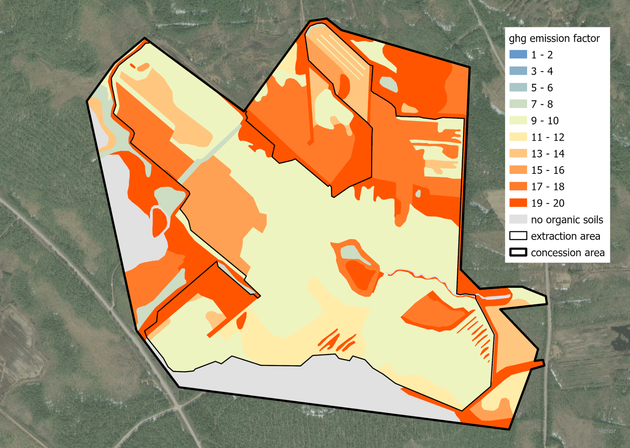
Greenhouse gas emissions in the current state, mapped by emission factor
3
Secure
Land purchase or rental agreement
We secure the site for the long term – by purchase or a long-term lease with the landowner – so the restoration effect is protected for decades.
Purchase or long-term lease
Legal due diligence
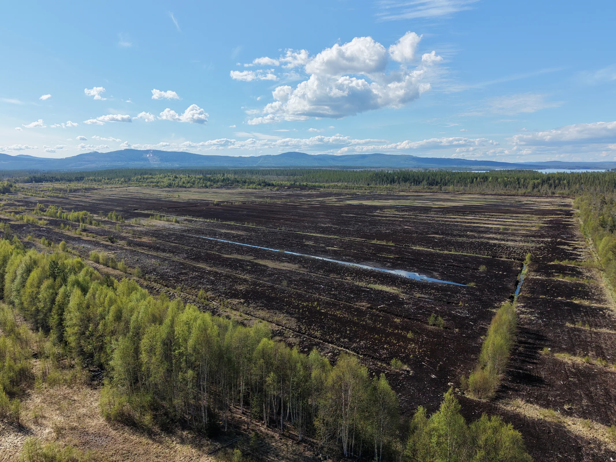
Svenskemyr, Sweden
4
Measure & plan
Baseline study
A detailed field survey documents the starting point: peat cores reveal depth and stratigraphy, drone flights deliver a high-resolution elevation model, and vegetation is mapped as habitat types – the basis for every later calculation.
Peat coring & stratigraphy
Digital elevation model
Habitat mapping (EUNIS, GEST)
Hydrology
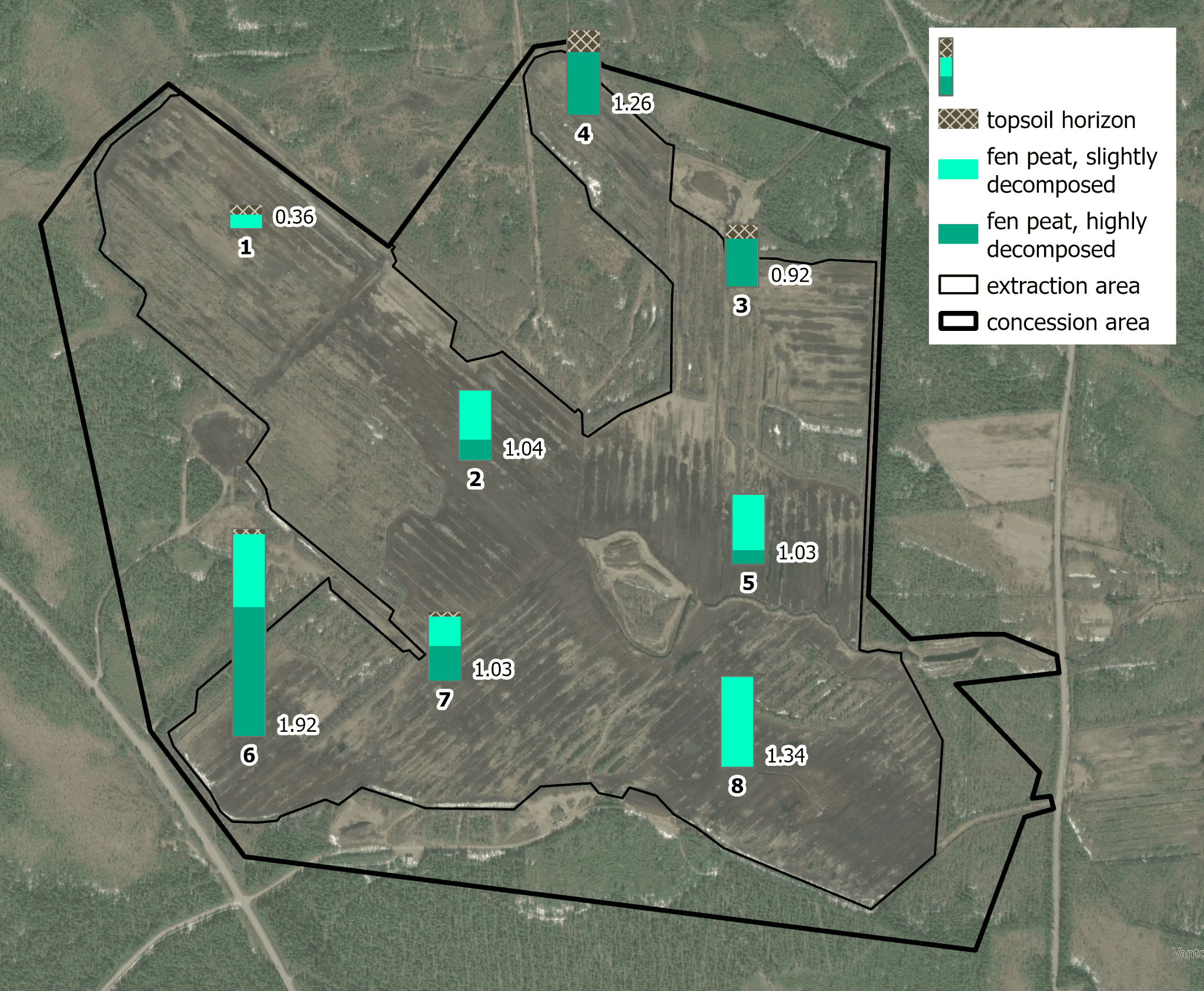
Peat coring locations and stratigraphy
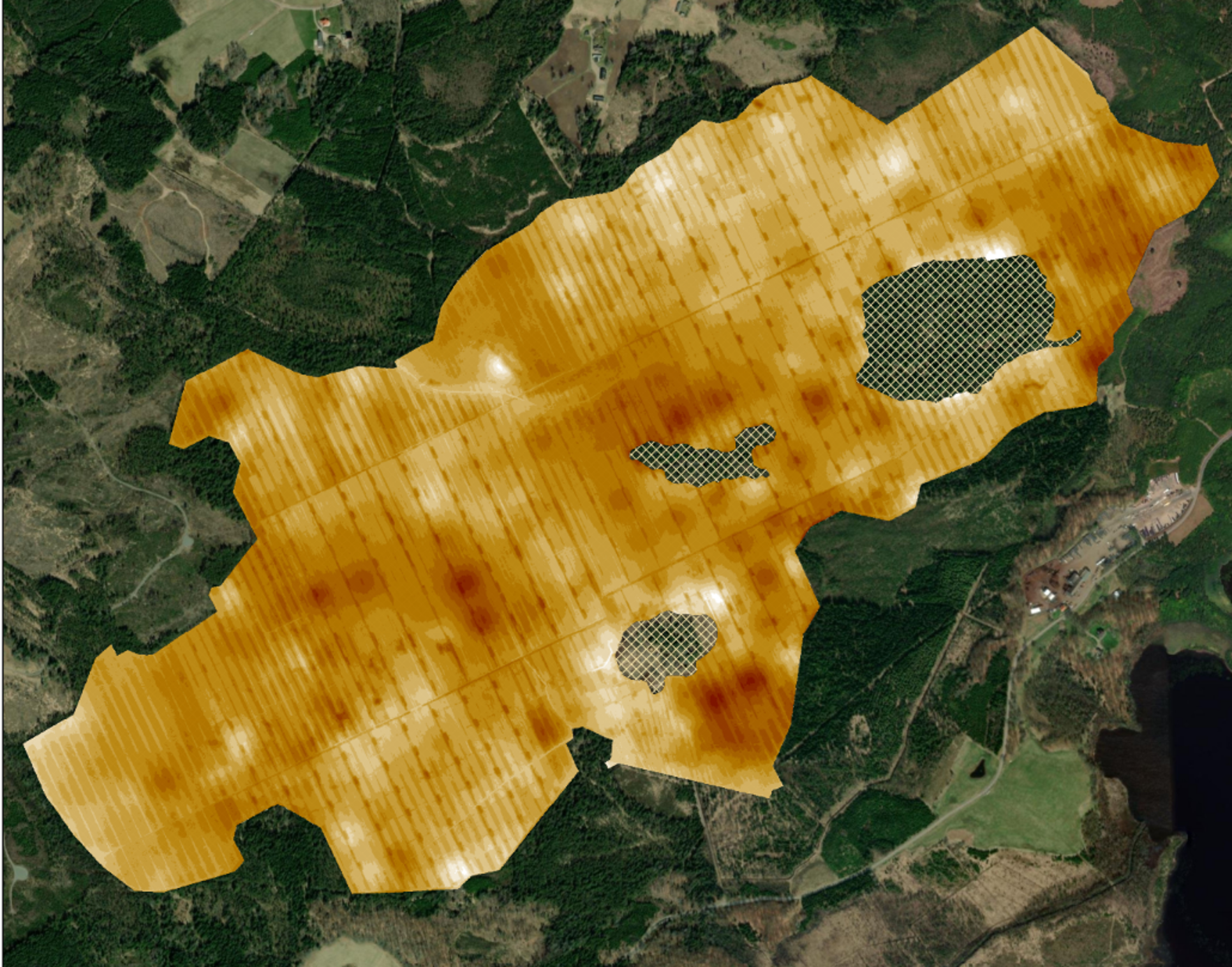
Interpolated peat thickness
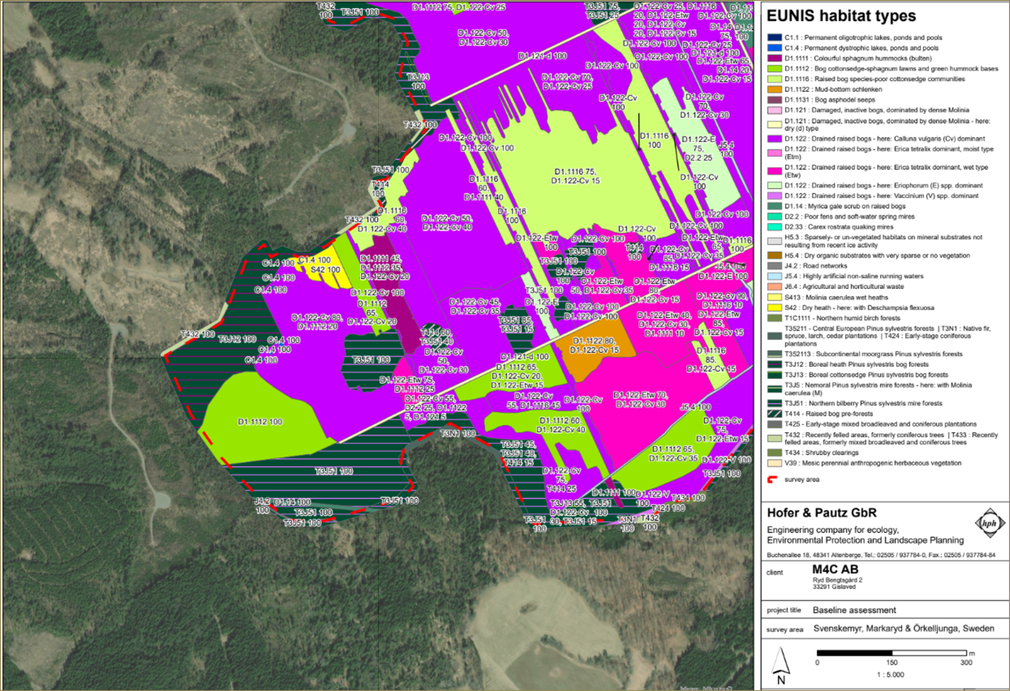
Habitat mapping (EUNIS)
5
Measure & plan
Restoration plan & approval
Using the elevation model, we design where ditches are blocked and dams are built to raise the water table across the whole site – and obtain all necessary permits.
Hydrological design
Dam & ditch plan
Permits
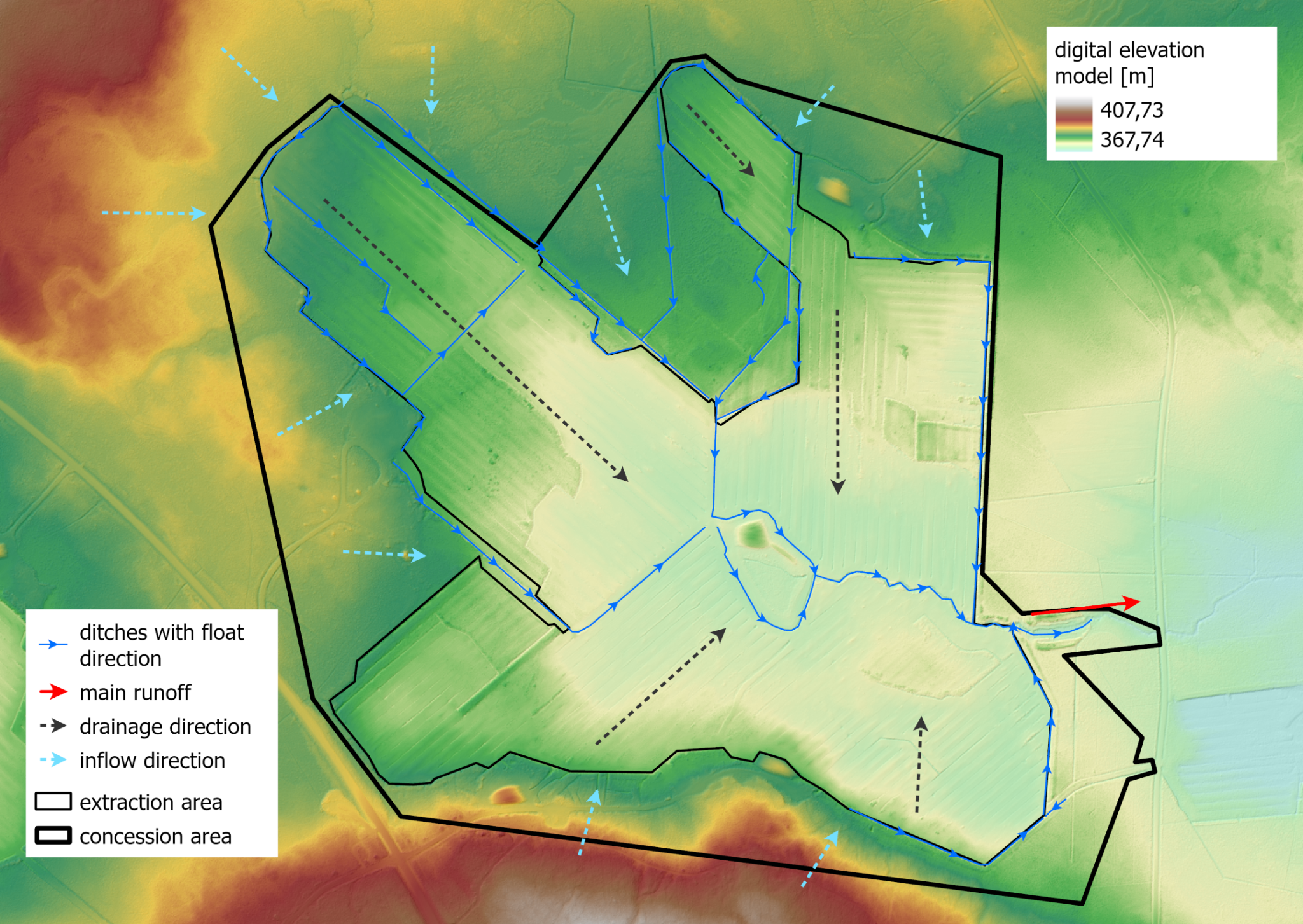
Elevation model with drainage and flow directions
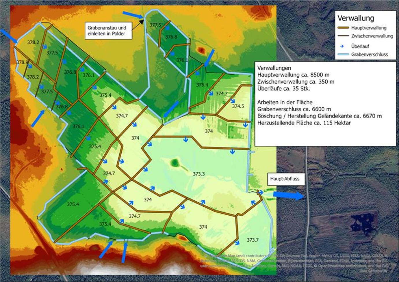
Restoration plan: dams and ditch blocking
6
Measure & plan
Monitoring concept
Before construction starts, we define how success will be measured: water-level loggers and reference points across the site, permanent plots for vegetation surveys, and a schedule for inspecting every dam and blocked ditch.
Water levels
Vegetation plots
Inspection of dams & ditches
Reference points
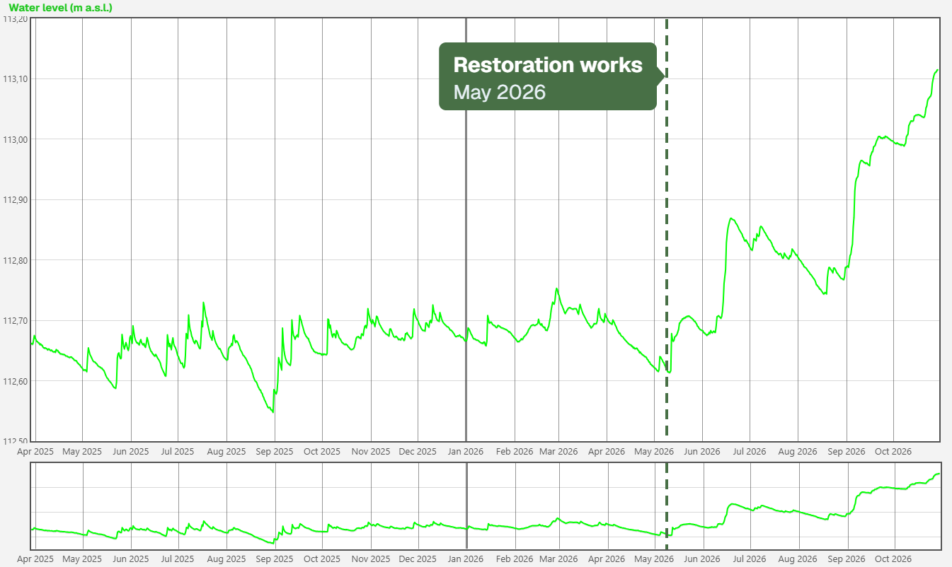
Data-logger water level over 18 months: a clear rise after the restoration works in May 2026
7
Restore & monitor
Restoration implementation
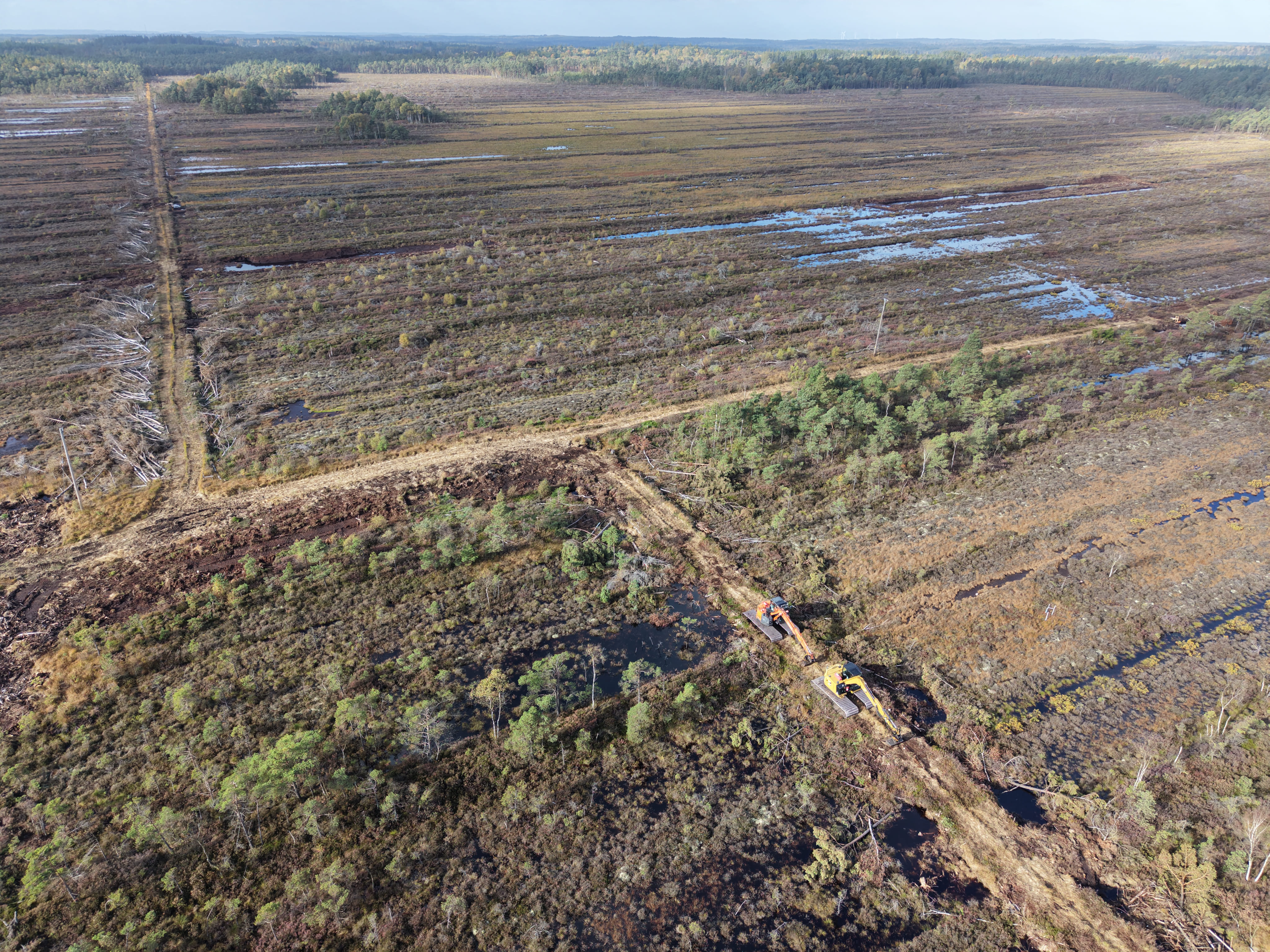
Ditches are blocked, dams are built and trees are removed where needed – raising the water table and restoring the conditions for peat-forming vegetation.
Ditch blocking
Dam construction
Tree removal where needed

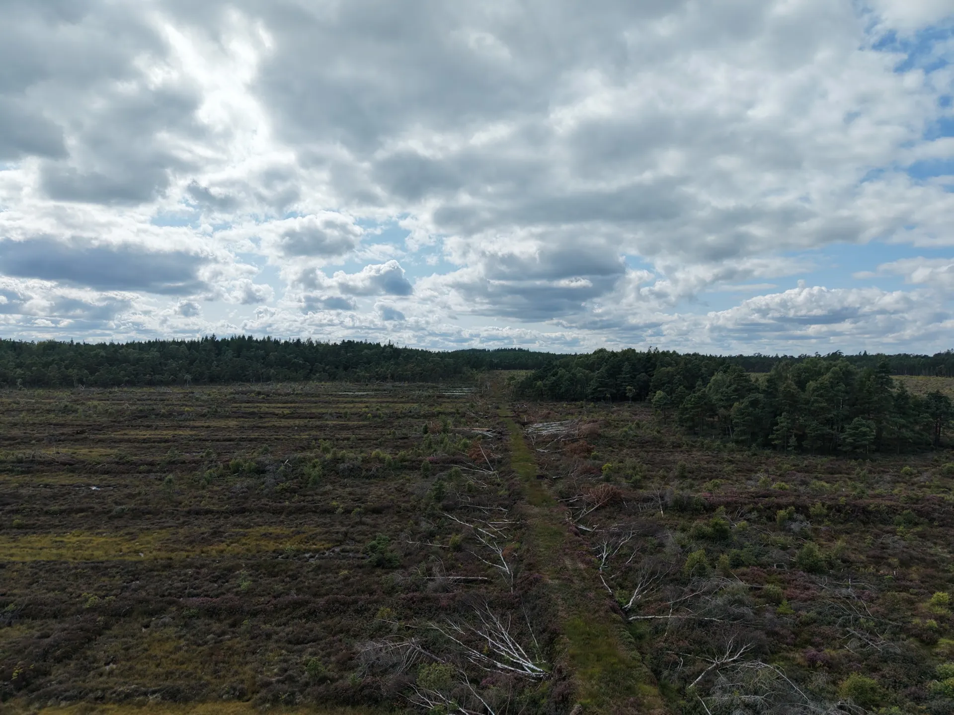
Svenskemyr, Sweden
8
Restore & monitor
Long-term monitoring – up to 40 years
For up to 40 years we track water levels, the development of peat-forming vegetation and the condition of all dams and blocked ditches – with sensors, field surveys, drones and satellites. Where a structure needs repair, we act; the results are reported transparently.
Water levels
Vegetation surveys
Inspection of structures
Drone & satellite imagery
Transparent reporting
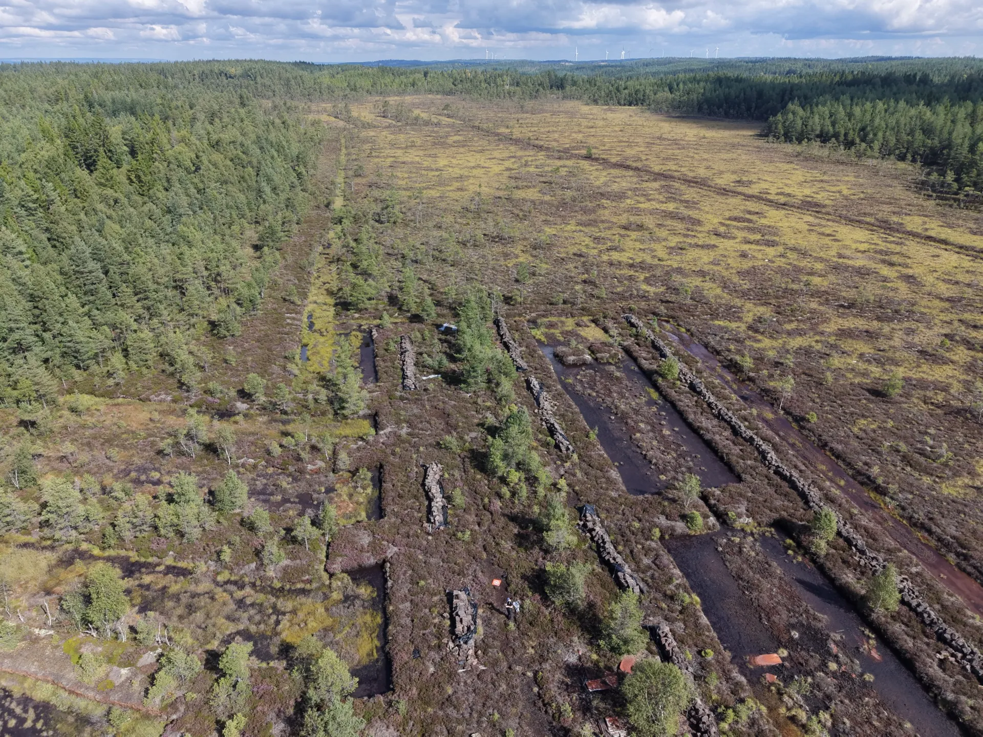
Baremossen, Sweden
In the field
Before, during and after
Scroll sideways to see more →
Before – active extraction
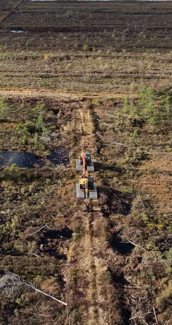
During – building dams
After – water returns
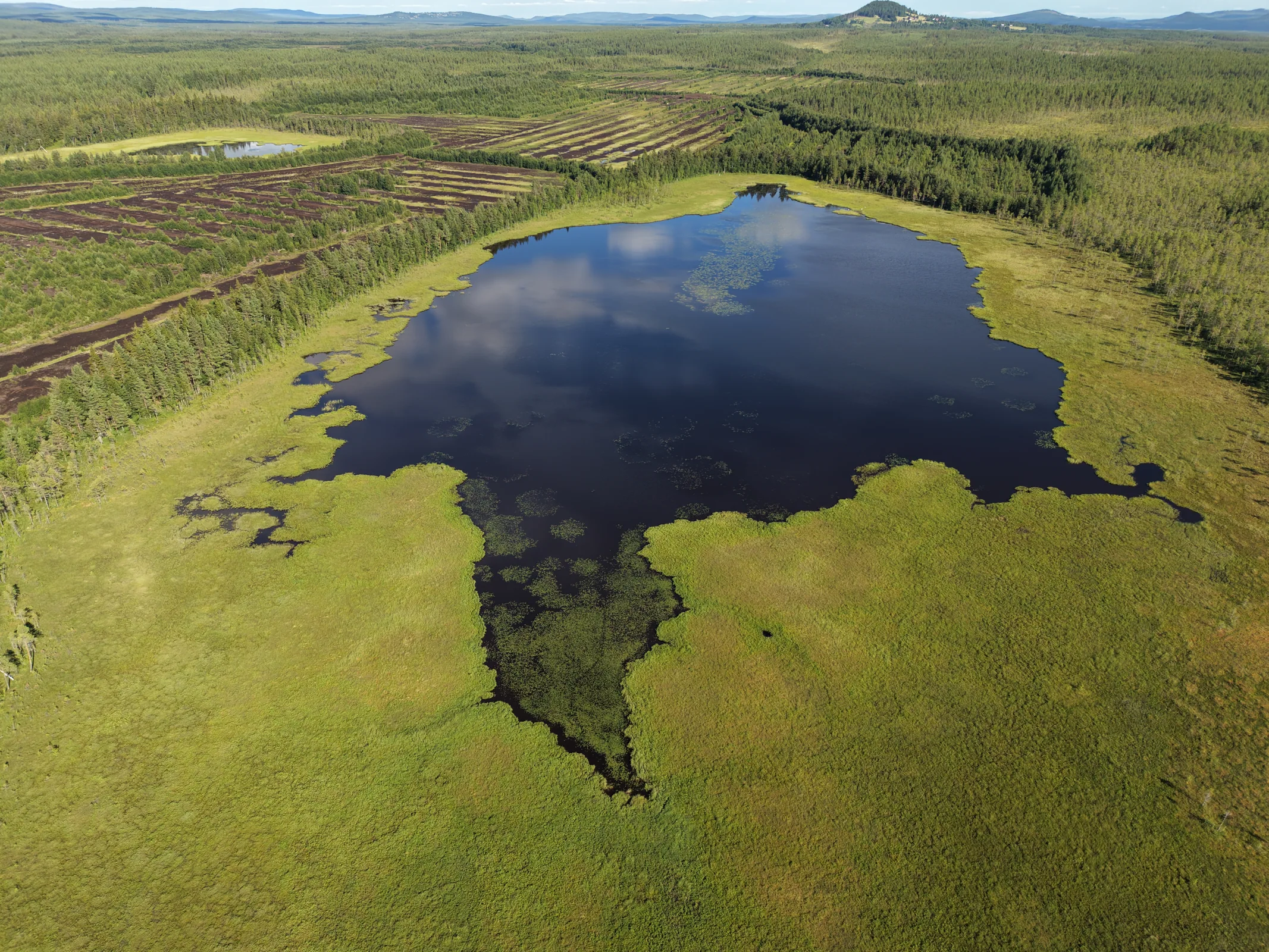
Living peatland

Natural reference mire